


Description
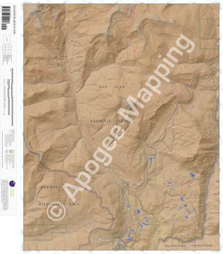
Prominent Features:
Weminuche Wilderness, San Juan National Forest, Engineer Mountain, Graysill Mountain, Sliderock Ridge, Grayrock Peak, Potato Hill, Coal Bank Pass, Boyce Lake, Potato Lake, Scout Lake, Colorado Trail, Rico-Silverton Trail, Graysill Trail, Engine Creek Trail, Engineer Mountain Trail, Deer Creek Trail, Coal Creek Trail, Pass Trail, West Lime Creek Trail, Cascade Creek Trail, Spud Lake Trail, Purgatory Trail, Durango Mountain Resort (Purgatory Ski Resort), Columbine Ranger Station, Mill Creek Lodge, Deer Creek Observation Point, Old Lime Creek Campground.
Adjacent Maps:
NW: Mount Wilson, CO
N: Ophir, CO
NE: Silverton, CO
W: Hermosa Peak, CO
E: Snowdon Peak, CO
SW: Elk Creek, CO
S: Electra Lake, CO
SE: Mountain View Crest, CO
Digital Map:
The free Avenza Maps App provides customers the ability to purchase digital versions of all amTopo maps for both online and offline use. The Avenza Maps App lets you see your current GPS location and utilize navigation, tracking, and measuring tools plus add map features and layers.
To purchase a digital copy now, choose from the following links:

To get started, download the Avenza Maps App, then visit the Apogee Mapping, Inc. Avenza Digital Map Store to browse all available maps.


Reviews
There are no reviews yet.