


Description
Prominent Features:
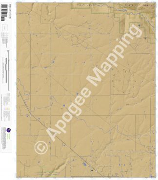
Canyons of the Ancients National Monument, San Juan National Forest, Lone Dome State Wildlife Area, Yellow Jacket Canyon, Brumley Draw, Ryman Draw, West Ryman Draw, Sandstone Canyon, Ferris Canyon, Salter Canyon, Lone Dome, Narraguinnep Reservoir, Dolores River, Dove Creek Canal, U Lateral, Lewis, Yellow Jacket, Ferris Campground.
Adjacent Maps:
NW: Cahone, CO
N: Doe Canyon, CO
NE: Narraguinnep Mountain, CO
W: Pleasant View, CO
E: Trimble Point, CO
SW: Woods Canyon, CO
S: Arriola, CO
SE: Dolores West, CO
Digital Map:
The free Avenza Maps App provides customers the ability to purchase digital versions of all amTopo maps for both online and offline use. The Avenza Maps App lets you see your current GPS location and utilize navigation, tracking, and measuring tools plus add map features and layers.
To purchase a digital copy now, choose from the following links:

To get started, download the Avenza Maps App, then visit the Apogee Mapping, Inc. Avenza Digital Map Store to browse all available maps.


Reviews
There are no reviews yet.