


Description
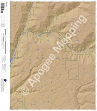
Prominent Features:
San Juan National Forest, Stoner Mesa, Taylor Mesa, Haycamp Mesa, Spruce Water Canyon, Morgan Gulch, Loading Pen Canyon, Garrison Canyon, Dolores River, West Dolores River, Stoner Creek, Rock Spring Creek, Lost Canyon Creek, Spring Creek, Fivemile Creek, Boggy Draw OHV Trail, Stoner Creek Trail, Pipe Creek Trail, Loading Pen Trail, Stoner, The Stoner Ranch, Stoner Ski Area, The Forks Campground, Canyon Vista.
Adjacent Maps:
NW: Willow Spring, CO
N: Nipple Mountain, CO
NE: Clyde Lake, CO
W: Boggy Draw, CO
E: Wallace Ranch, CO
SW: Dolores East, CO
S: Millwood, CO
SE: Rampart Hills, CO
Digital Map:
The free Avenza Maps App provides customers the ability to purchase digital versions of all amTopo maps for both online and offline use. The Avenza Maps App lets you see your current GPS location and utilize navigation, tracking, and measuring tools plus add map features and layers.
To purchase a digital copy now, choose from the following links:

To get started, download the Avenza Maps App, then visit the Apogee Mapping, Inc. Avenza Digital Map Store to browse all available maps.


Reviews
There are no reviews yet.