


Description
Prominent Features:
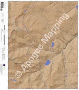
Weminuche Wilderness, Rio Grande National Forest, Mount Hope, Table Mountain, Heart Mountain, Metroz Mountain, Tie Hill, Big Meadows Reservoir, Shaw Lake, Metroz Reservoir, Pass Creek Lake, Spruce Lakes, Hunters Lake, South Fork Rio Grande, Gibbs Creek, Archuleta Creek, Spruce Creek, Pass Creek, Lake Fork, Kitty Creek, Decker Creek, Continental Divide National Scenic Trail, Highline Trail, Lake Fork National Recreation Trail, Skyline Trail, Kitty Creek Trail, Hope Creek Trail, Archuleta Trail, South Fork Trail, Big Meadows Loop Trail, Decker Trail, Tie Hill Trail, Hunters Lake Trailhead, Big Meadows/Archuleta Trailhead, Big Meadows Campground, Columbine Picnic Area, Lake Fork Trailhead, Lake Fork Rest Area.
Adjacent Maps:
NW: Spar City, CO
N: Lake Humphreys, CO
NE: South Fork West, CO
W: South River Peak, CO
E: Beaver Creek Reservoir, CO
SW: Saddle Mountain, CO
S: Wolf Creek Pass, CO
SE: Elwood Pass, CO
Digital Map:
The free Avenza Maps App provides customers the ability to purchase digital versions of all amTopo maps for both online and offline use. The Avenza Maps App lets you see your current GPS location and utilize navigation, tracking, and measuring tools plus add map features and layers.
To purchase a digital copy now, choose from the following links:

To get started, download the Avenza Maps App, then visit the Apogee Mapping, Inc. Avenza Digital Map Store to browse all available maps.


Reviews
There are no reviews yet.