


Description
Prominent Features:
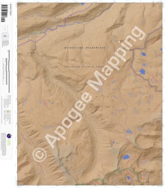
Weminuche Wilderness, Rio Grande National Forest, San Juan National Forest, Continental Divide, Chief Mountain, Knife Edge, Ruby Lake, Little Ruby Lake, Fuchs Reservoir, Red Lakes, Trout Lake, Williams Lakes, Cherokee Lake, Rio Grande, Grizzly Creek, Little Spruce Creek, West Trout Creek, Texas Creek, Quartz Creek, Fern Creek, Continental Divide National Scenic Trail, West Trout Trail, Williams Fork Lake Trail, Texas Creek Trail, Grizzly Creek Trail, Grizzly Lake Trail, Fern Creek Trail, Fern Creek Cutoff Trail, Red Lakes Trail, River Hill Campground.
Adjacent Maps:
NW: Finger Mesa, CO
N: Hermit Lakes, CO
NE: Bristol Head, CO
W: Weminuche Pass, CO
E: Workman Creek, CO
SW: Granite Lake, CO
S: Cimarrona Peak, CO
SE: Palomino Mountain, CO
Digital Map:
The free Avenza Maps App provides customers the ability to purchase digital versions of all amTopo maps for both online and offline use. The Avenza Maps App lets you see your current GPS location and utilize navigation, tracking, and measuring tools plus add map features and layers.
To purchase a digital copy now, choose from the following links:
 Little Squaw Creek, CO – Color Hillshade Little Squaw Creek, CO – Greyscale Hillshade
To get started, download the Avenza Maps App, then visit the Apogee Mapping, Inc. Avenza Digital Map Store to browse all available maps.


Reviews
There are no reviews yet.