


Description
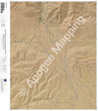
Prominent Features:
San Juan National Forest, Perins Peak State Wildlife Area, La Plata Mountains, Parrott Peak, Baldy Peak, Ohwiler Ridge, Paine Ridge, Snowslide Gulch, Little Deadwood Gulch, Sawmill Canyon, Hopkins Draw, Cherry Gulch, Sheep Springs Gulch, Hay Gulch, Spring Gulch, East Alkali Gulch, West, Middle and East Roberts Canyon, La Plata River, Cherry Creek, Starvation Creek, Deadwood Creek, Parrott Creek, South Fork Lightner Creek, Railroad Loop Trail, Hesperus, Fort Lewis, Mayday, Hesperus Ski Center, Snowslide Campground, Bay City Campsite, Cherry Creek Picnic Area, Mines.
Adjacent Maps:
NW: Rampart Hills, CO
N: La Plata, CO
NE: Monument Hill, CO
W: Thompson Park, CO
E: Durango West, CO
SW: Mormon Reservoir, CO
S: Kline, CO
SE: Basin Mountain, CO
Digital Map:
The free Avenza Maps App provides customers the ability to purchase digital versions of all amTopo maps for both online and offline use. The Avenza Maps App lets you see your current GPS location and utilize navigation, tracking, and measuring tools plus add map features and layers.
To purchase a digital copy now, choose from the following links:

To get started, download the Avenza Maps App, then visit the Apogee Mapping, Inc. Avenza Digital Map Store to browse all available maps.


Reviews
There are no reviews yet.