


Description
Prominent Features:
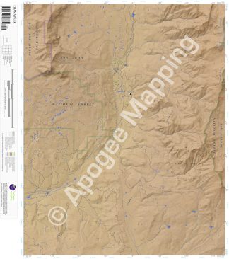
South San Juan Wilderness, San Juan National Forest, Rio Grande National Forest, Continental Divide, Chalk Mountains, Chama Peak, Banded Peak, Navajo Peak, Tierra Amarilla Land Grant, Weisel Canyon, Road Canyon, Ant Gulch, House Canyon, Price Lakes, Dolomite Lake, Hidden Lake, Navajo River, Rio Chamita, Bear Creek, Little Muddy Creek, We Creek, Headache Creek, Big Muddy Creek, Cutthroat Creek, Skeeter Creek, Indian Creek, Sixto Creek, Hughes Trail, Banded Peak Ranch (Lower Camp), Gramps Oil Field.
Adjacent Maps:
NW: Harris Lake, CO
N: Elephant Head Rock, CO
NE: Victoria Lake, CO
W: Chromo, CO
E: Archuleta Creek, CO
SW: Monero, NM
S: Chromo Mountain, NM
SE: Chama, NM
Digital Map:
The free Avenza Maps App provides customers the ability to purchase digital versions of all amTopo maps for both online and offline use. The Avenza Maps App lets you see your current GPS location and utilize navigation, tracking, and measuring tools plus add map features and layers.
To purchase a digital copy now, choose from the following links:
 Chama Peak, CO – Color Hillshade Chama Peak, CO – Greyscale Hillshade
To get started, download the Avenza Maps App, then visit the Apogee Mapping, Inc. Avenza Digital Map Store to browse all available maps.


Reviews
There are no reviews yet.